Severe Storms Possible in Acadiana Through Sunday
No, we won't be under the gun for severe storms the entire weekend but the forecast is a roller coaster ride of different weather events, some of them could be a bit bumpy. If there's a good news portion of the forecast it would be this. It appears as though the bulk of the showers and storms forecast for today have already moved through.
Don't get too excited.
The threat of showers and storms is expected to build back in for later this evening. The Storm Prediction Center currently has most of southwest Louisiana in the marginal risk zone for severe storms.
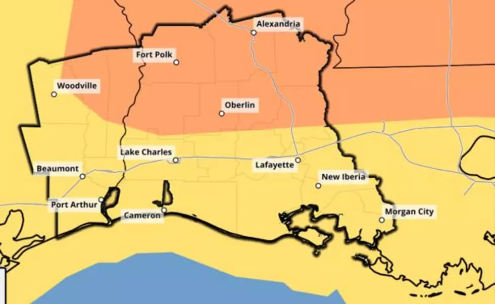
After tonight's storms roll through we should have a few hours of calm and maybe even nice conditions. Those conditions will go downhill quickly on Sunday afternoon. That's when the SPC has the general area north of U.S. 190 in an enhanced risk for severe storms, while the area south of the highway is in the slight risk category. That's the map you see at the top of this story, by the way.
Forecasters believe the showers and storms will exit Acadiana in the overnight hours of Sunday into Monday. Then the first few days of the next workweek should be very springlike with temperatures rising into the mid-80s.
So, if you wanted to get out in your garden you could do that a little bit today and tomorrow, but next week really looks like it will be the best time for yard work.
.
9 STEPS TO BUILDING THE PERFECT BOX GARDEN
More From Hot 107.9