4 PM Advisory: Hurricane Ida Still Churning Through Southeast La. as Cat 4
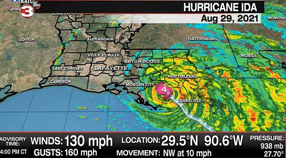
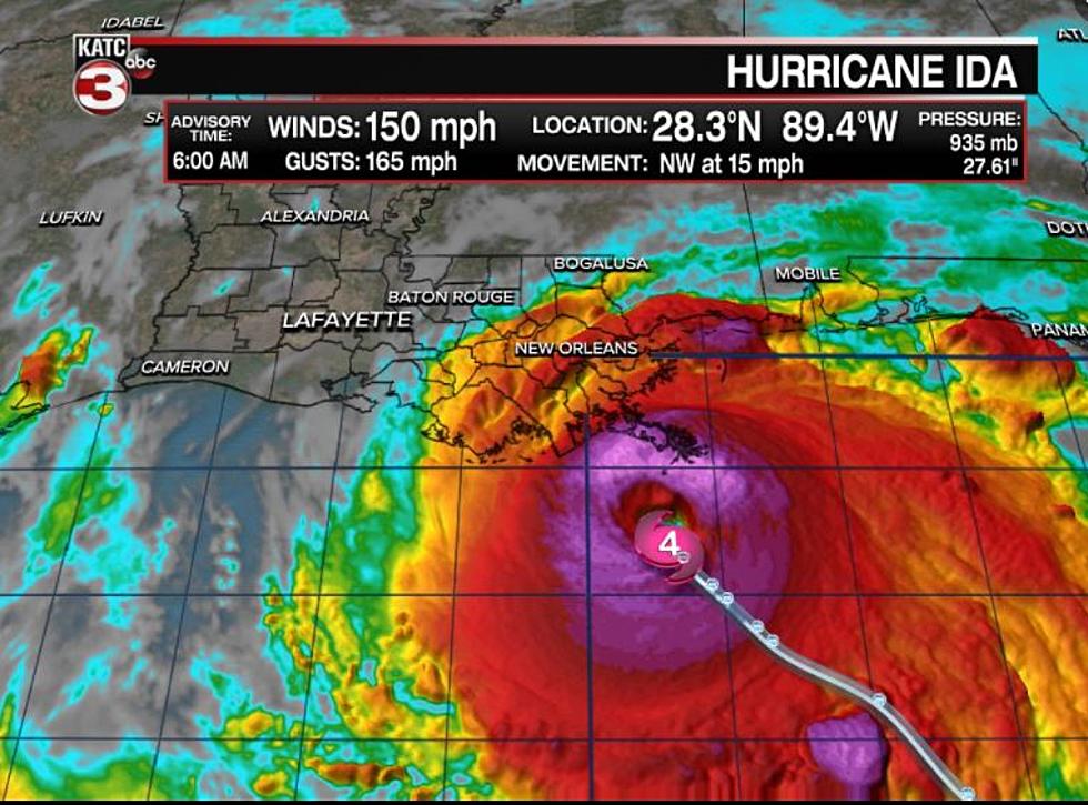
Hurricane Ida continues to barrel through Southeast Louisiana as a low Category 4 storm, dropping from 150 mph sustained winds at landfall to 130 mph sustained winds.
That's according to the 4 PM Advisory from the National Hurricane Center. Ida is moving northwestward over southeastern Louisiana with a catastrophic storm surge, extreme winds, and flash flooding. Metro New Orleans is under a flash flood warning.
Meteorologist Scot Pilie, who works in the Nola area, paints a grim picture and gives his unique perspective on the landfall that has still not significantly weakened Ida.
Ida's location as of the 4 PM Advisory: 29.5 N, 90.6 W; about 45 miles southwest of New Orleans and about 70 miles south-southeast of Baton Rouge.
The 4 PM Advisory did bring changes with it.
The Hurricane Warning along the coast of Louisiana from Morgan
City to Intracoastal City has been changed to a Tropical Storm
Warning.

The Tropical Storm Warning from Cameron to Intracoastal City
Louisiana has been discontinued.

The Storm Surge Warning west of Morgan City has been discontinued.
As far as Acadiana goes, KATC Chief Meteorologist Rob Perillo uses the Power Doppler 3 radar to show you the lightning activity the region has seen over the last hour.
According to the National Weather Service out of Lake Charles, these are the expected winds for Lafayette and the surrounding Acadiana region tonight into tomorrow.
LIST: 10 Deadliest Louisiana Hurricanes
Six Things A Cajun Needs To Survive A Storm
Aerial Pictures of Southwest Louisiana Before & After Hurricane Laura
Things You Want or Need After Surviving A Hurricane
More From Hot 107.9
![Louisiana Family Living in Vehicle After Hurricane Ida Destroys Home [VIDEO]](http://townsquare.media/site/34/files/2021/09/attachment-Screen-Shot-2021-09-29-at-7.43.01-AM.jpg?w=980&q=75)
![Lafourche Parish Residents Say They’re Now Living in Polluted Mud [PHOTOS]](http://townsquare.media/site/34/files/2021/09/attachment-Screen-Shot-2021-09-20-at-4.46.56-PM.jpg?w=980&q=75)


![LIVE Footage From Grand Isle as Hurricane Ida Approaches [WATCH]](http://townsquare.media/site/34/files/2021/08/attachment-Screen-Shot-2021-08-29-at-11.36.19-AM.jpg?w=980&q=75)


