New ‘Cone of Uncertainty’ Released Ahead of Louisiana, Texas Hurricane Season
Lafayette, LA (KPEL News) - Louisiana and Texas know all too well that watching the development and progress of a hurricane or tropical system is like being stalked by a turtle. When we see our area anywhere within the 'cone of uncertainty,' no matter how far out the system is, we check the forecast more than we check social media.
Local meteorologists know to expect all the questions.
How strong will it be? When will it hit? Should I leave? Will it be bad at my house? What about (insert town name)?
Having worked in the same room with television meteorologists for more than 15 years, I can assure you that they are vigilant about answering as many of those questions as they can to keep us safe, and they rely on the data coming from all the credible sources so they can share the most accurate information.
Their forecasts and answers rely heavily on data coming from the National Hurricane Center (NHC).
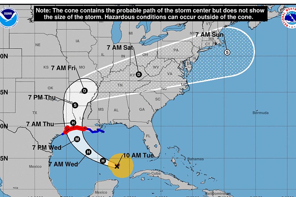
Fortunately, the science of hurricane forecasting has come a long way. Those of us who live along the coast of the Gulf of Mexico know well what the 'cone of uncertainty' looks like.
Since 2002, it has looked like the one pictured below:
The National Hurricane Center has developed an experimental new 'cone of uncertainty' graphic that, they hope, will communicate the information they have better and allow for more information to be shared on one screen.
The forecast track, typically referred to as 'the cone,' will be overlaid with colors indicating which areas are under specific watches or warnings. These areas will be the most prominent feature on the cone.
And rather than a 3-day track and a 5-day track differentiated on the experimental cone, you'll see the watch and warning areas on the 5-day forecast track.
Interestingly, you'll notice on the experimental model that the edges for the watches and warning are jagged. There's a reason for that.
Oftentimes, people stop paying attention when they see that their area is outside the cone. However, history has shown that the effects can be felt in those areas. While they may not be as significant, the wind and rain have been forces to contend without in the outer areas, and sometimes people are caught off guard.
Not good.
The new version of the 'cone of uncertainty' is experimental, and the National Hurricane Center needs our help making sure that it is effective. They will be asking for input from their partners to determine whether modifications need to be made.
The primary goal is to find ways to simply and effectively communicate tropical cyclone risk without making the graphic too complicated.
We won't see it in use when hurricane season begins. They plan to start rolling it out in mid-August and will let us know when and how we can provide feedback.
Hurricane season 2024 will be here before we know it. Remember to stay weather-aware and pay attention to your local meteorologists. They will be there to provide all the necessary information so we can stay safe if and when our areas are under the threat of a tropical system.
25 costliest hurricanes of all time
Louisiana's Most Devastating Hurricanes

More From Hot 107.9
