Second Tropical Wave Being Monitored for Development
By the end of June in last year's record-breaking hurricane season, there had been four named storms in the tropical Atlantic Basin. The way things appear to be shaking out in Hurricane Season 2021 we could be looking at our fourth named storm in the tropics before we turn the calendar page to July.
As you can see, the Gulf of Mexico looks pretty calm this morning.
This year's hurricane season is forecast to be active but not nearly as active as Hurricane Season 2020. However, recent activity in the tropics is suggesting that, at least through the first month of the season, this year is keeping up with last year.
Already this year we have had three named storms. Tropical Storm Ana, Tropical Storm Bill, and the most recent storm to make landfall in Louisiana Tropical Storm Claudette. Based on observations from the National Hurricane Center, we could be watching the development of Dolly over the next five days,
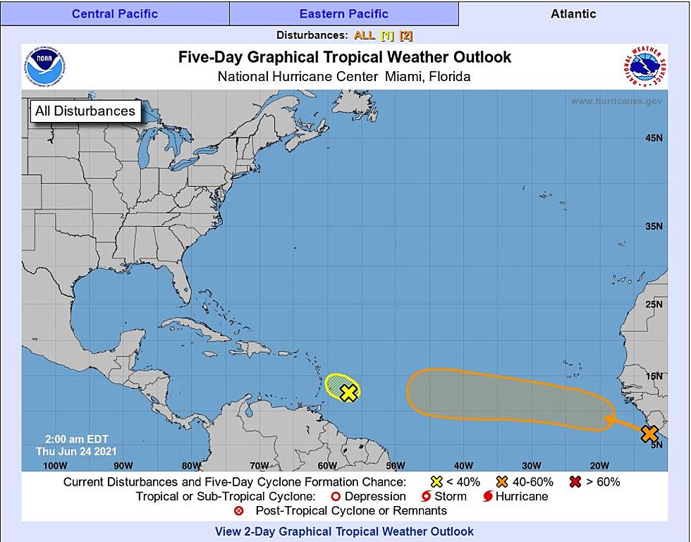
Currently, there are two tropical waves being monitored in the tropical Atlantic for development. Those waves are located just east of the Windward Islands and just off the continent of Africa in the far-eastern Atlantic.
The tropical wave that is near the Windward Islands is not showing great signs of development. Forecasters with the National Hurricane Center are giving this system a less than 20% chance of developing into a tropical cyclone within the next five days.
The wave that is just off the coast of Africa appears to be more robust. In fact, the GFS weather model actually carries this system across the Atlantic into the Caribbean and eventually into the Gulf of Mexico by this time next week. Now that is a long-range projection for sure, but the model has remained consistent in this solution for the past several days. So, I would keep my eyes on the Gulf beginning next week.
While we are watching, it might be a good idea to stay cool. Here's how you can help your air conditioner do its job.
12 Ways to Help Your Air Conditioner Cool Your Home Better
More From Hot 107.9
