Tropical Update – 4 AM Advisory Adjusts Storm Tracks Slightly
If we were to choose a "word of the year" for the year 2020 I think that word would have to be unprecedented. We've seen so many things this year that were never ever thought we'd see in our lifetimes. The current tropical weather forecast is one of those things.
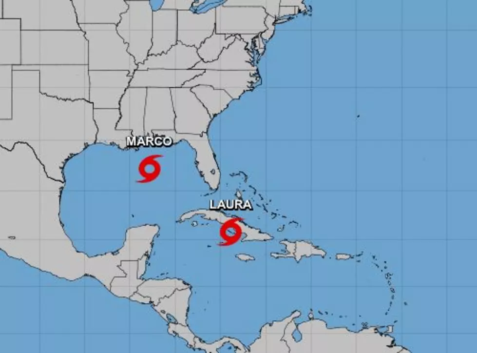
Forecasters with the National Hurricane Center are currently tracking Tropical Storm Marco and Tropical Storm Laura. During the nighttime hours, Marco weakened just a little and was downgraded to tropical storm status late last night. Laura continues to be a tropical storm but is expected to strengthen over the next few days.
Here is the latest on both storms as of the 0400 CDT Advisory from the National Hurricane Center.
Marco continued to weaken during the overnight hours. Therefore all Hurricane Warnings have been discontinued. The storm was located about 115 miles south southeast of the mouth of the Mississippi River. Marco was moving to the northwest at about 10 mph. Maximum sustained winds were reported to be near 60 mph.
The latest tropical model runs for Marco suggest the storm will move in the general direction of the southeast coast of Louisiana during the day today. Most of the model guidance still expect landfall in southeast Louisiana west of the mouth of the Mississippi River. But that landfall will barely be a landfall as Marco is expected to hug the coast as it slides westward during the evening hours tonight and during the day tomorrow.
Marco is not expected to reintensify into a hurricane before landfall. At least that is the opinion of forecasters at the National Hurricane Center early this morning.
Now, for Tropical Storm Laura,
The center of Tropical Storm Laura was located just south of the southwestern coast of Cuba about 255 miles east southeast of the Isle of Youth. Laura had sustained winds of 65 mph and was moving toward the west-northwest at about 21 mph. Laura is expected to strengthen as it moves across the Gulf of Mexico over the next few days. It could be a category 2 hurricane on the Saffir-Simpson scale at landfall early Thursday morning.
The latest tropical model runs for Laura shows there is a little more discrepancy among the model outcomes. Model guidance earlier in the day had been tightly bunched suggesting Laura would make landfall near Vermilion Bay. The new model runs do show several model outcomes that shift the track of Laura a little further to the west. The track guidance from the Hurricane Center reflects that shift westward.
Regardless of the actual track of the center of the storm, we remind you that these weather systems cover a lot of miles in scope, so don't just pay attention to where the center goes. Most of the worst of the weather associated with these systems will be hundreds of miles away from the center of circulation.
Also, these storm systems have proven to be very difficult to forecast so you should remain weather aware should there be changes in track guidance or fluctuations in intensity.
10 Smallest Towns in Louisiana
More From Hot 107.9