Tropical Weather Maker Could Affect Louisiana Later This Week
We will stop short of saying you need to dust off your hurricane kit, at least for now. But there will likely be some changes coming in our South Louisiana forecast over the next five days. Toward the end of that time period, those changes could be the result of a tropical weather system now forecast to move closer to Louisiana's coastline this weekend.
First things first, a cold front is expected to push through the area Wednesday morning. That frontal system will bring the threat of more showers and some cooler temperatures to the region for Wednesday afternoon and Thursday.
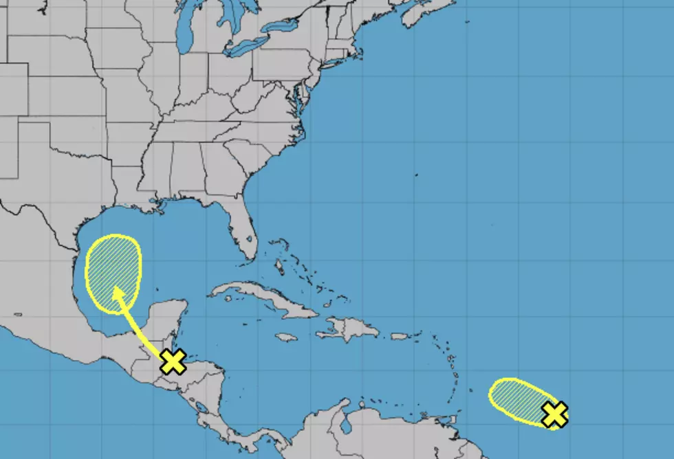
While that front is sliding through Louisiana, well to the south an area of disturbed weather is expected to slide across Mexico's Yucatan Peninsula and move northward into the western Gulf of Mexico.
Forecasters are giving this system a 30% probability of strengthening into a tropical cyclone by Saturday. Regardless of strength, the system could be close enough to Louisiana's coast to begin funneling moisture into the state.
This could be the reason why some of the long-range forecasts have rain chances returning to the area late in the weekend and early next week. Naturally, this is a wait and see kind of situation. These kinds of weather makers that offer "unnamed rain" can really cause a lot of problems where rain and flooding issues are concerned.
More From Hot 107.9