Significant Severe Weather Threat in Acadiana Today
A strong cold front pushing across the Great Plains will swoop into and through Louisiana later this afternoon and evening. During the passage of the front, there will be a significant risk for severe storms and possible tornadoes.
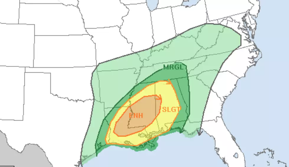
The Storm Prediction Center has placed much of northern Acadiana in an "enhanced risk" zone for severe storms today. The way that breaks down into percentages is like this. There is a 5% probability that within the confines of the forecast area there could be a tornado form. There is also a 15% probability that the forecast area could receive hail.
There is a 30% probability that the forecast area could experience damaging winds too. These gusty winds will likely be a part of a line of thunderstorms that are expected to move through the area between 4 pm and 10 pm this afternoon and evening. Those storms are expected to form closer to the frontal boundary so as they move through, we should notice a change in conditions behind the front.
Speaking of conditions behind the front, the forecast for this week before Christmas should feel very Christmas-like. Temperatures should remain below or near seasonal normals for the balance of the workweek. This should help keep holiday shoppers in the right frame of mind for last-minute holiday gift buying.
More From Hot 107.9