Timing Today’s Severe Weather Threat in Acadiana
As a person who has spent the better part of four decades hanging around with people who forecast the weather for a living I can tell you the one question they all hate is this one, "When's it gonna rain"? Well, back in the day an answer to that question was a bona fide guess. With today's modern forecasting tools, the weather guessers aren't leaving it to guesswork for an answer.
In a post published on the KATC website meteorologist Daniel Phillips explained that forecast models predict the worst of Acadiana's weather today will likely come this evening between 7 pm and 10 pm. The storms will be moving in and through the area as part of a frontal system that is going to bring some decidedly cooler temperatures to the area for the weekend.
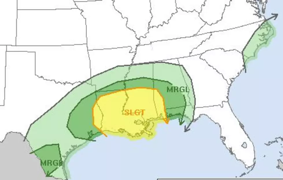
There is a threat of severe storms over most of Louisiana today. The Storm Prediction Center has just about all of the state in the slight risk zone. That's the yellow area you see indicated in the image above. Daniel says in his post that while there could be a threat of tornadoes the bigger threats from these storms will likely come in the form of gusty winds and small hail.
Before the stronger storms arrive later today you can expect winds to be very gusty. There is also the potential for an isolated or rogue thunderstorm to pop up ahead of the main squall line this evening.
We suggest you download and use the radio station's mobile app for your smartphone. Be sure you set up "ALERTS" to include Breaking News and Weather. That way should any watches or warnings be needed you'll have the information you need to keep your family safe right in your pocket.
10 Smallest Towns in Louisiana
More From Hot 107.9


